

In February of 2023, I served my last day as planning commissioner for District 1 in Murrells Inlet. My journey as a commissioner began in December 2018, at the beginning of updates to the Comprehensive Plan (CP). My County Council Representative at the time asked me to serve on the commission and when he left office was highly complementary of the work I was doing representing the Murrells Inlet community. As a lifetime resident, I love this place like many who live and visit here.
My time as a commissioner opened my eyes to many things going on in Georgetown County planning and suffice it to say, I know good planning when I see it. When I took the seat on the commission, I asked many questions that continued throughout my term.
After joining the American Planning Association several years ago, I learned about great places, planning practices, and the importance of good planning for communities futures. Wanting those things for Georgetown County is not enough to make them happen here. No consensus can be reached when lip service is intended.
Last month, I wrote about the update to the Land Use Element (LUE) of Georgetown County Comprehensive Plan. Last week, I attended the planning commissions workshop. Needless to say, many items pulled in and highlighted are not exactly accurate and as noted in yellow in the 3-25-24 draft, seem more about signaling we are listening to the citizens, than to actually really listen and getting this right.
For example on page 3 the highlighted box is added to emphasize the CP guides future growth and development and the zoning regulates and is used to implement the CP.
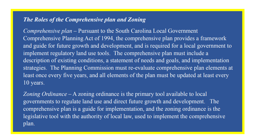
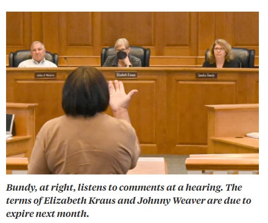
The Chair of the PC had one comment on this and ‘thanked’ the consultant for adding it here. I wonder if she or any other planning commissioner notice the missing part?
Why didn’t they also add - Future Land Use Maps are used for decision making?
In other words, if this box is added to inform the PC on how the Future Land Use Map (FLUM) will be USED TO CHANGE ZONING and should be used when EVALUATING PLANS that come before the commission, why is it missing here and stuck back on page 63? If you want to educate the public, the commissioners and county council on the importance of using this tool, why leave that out at the front of the LUE?
My second meeting as planning commissioner made it clear the CP and FLU map was to be used for making decisions. It was also made clear public input would be the next step in 2019. While the current LUE draft has lots of words about public meetings and input, not once has there been discussions about the problems, issues and concerns citizens have nor an opportunity for having MEANINGFUL discussions on solving them in the future. Only 1 of the open houses for the LUE updates allowed for citizens questions or dialogue.
While I served on the Planning Commission the one element that did have a great deal of public input and engagement was the Natural Resource Element. After 6 revisions, the NRE passed unanimously, only to be stripped of meaningful goals and objectives by county staff and killed by county council.
I could not understand why the newly elected Councilor for District 1 stood by and deferred the NRE 1 year ago after he removed me from the commission, since natural resources are so important to our local economy and an integral to the local culture. Until seeing the final draft of the LUE I remained clueless about how the NRE would conflict with the LUE because natural resources don’t move, unless we ignore them and pave them over. Apparent now is this has been the plan all along. How utterly mindless!
Having taken many APA classes and read many comprehensive plans and small area plans over the years and being involved in many communities work on visions and plans has served me well in evaluating good planning processes and plans. It pains me that we have such a disjointed effort and continue to spin our wheels here. If the draft passes we will all see the pain of lost forever opportunities to be in harmony with nature and protect it.
On page 33 of the draft this gem shows up to explain land constraints and magically ignores what ALL NEW DEVELOMENT needs to follow. Words matter!!!
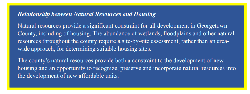
How many times does 96% of residents concern over natural resources need to be explained to county planners, the commission and county council?
It is mind numbing to see the tactics used to confuse the public and the new planning commissioners, some of which have been absent multiple times since being appointed to serve. Respecting the natural resources shouldn’t be only for new affordable units, it should be for ALL development. Maybe somebody should read the adopted Resilience Element and get some clues here! Consistency anyone?
The Comp Plan and all the elements are one of the most important functions of the planning commissioners yet most of them remain silent when it comes to giving direction to the consultants or county staff. The chair of the commission was quick to tell the newly appointed commissioner last week, “he picked a good meeting to start his term because no votes would be taken”. I wonder if he had any questions?
The fact that the CP update began as a top down approach from the onset in 2019 shows how badly this approach is going. After 5 years of false starts and failed public engagement, the new draft serves to increase density and does nothing to address the problems and issues residents deal with daily because the last plan has not been followed. Instead of having in place areas of medium density that should have been followed we are bypassing the former lower densities for higher density fast.
Forget about Natural Resources, they are in the way!
Nobody has suggested affordable housing is not needed here as affordability is an issue throughout the US. Nor has anyone suggested it should happen at the expense of historic settlement communities who built our county and are now being gentrified out of existence with new development. That belongs in the Housing Element which was updated and adopted in 2022. Anyone following it?
Ironically, if the county was really concerned with affordable housing, they wouldn’t keep approving projects that don’t align with the very land constraints and lack of infrastructure or the existing FLU maps they continued to ignore since they were adopted in 2010. Investments in infrastructure in settlement communities has been ignored for decades.
Another example from the 3-25-24 draft LUE - shows highlights of the Stormwater Master Plan (SMP) on page 40. Proclaiming the plans emphasis on stakeholder engagement is a big stretch. From the start of the development process the SMP was to plan for BUILD OUT of the Waccamaw Neck under existing zoning. What is really happening here?
Murrells Inlet’s Watershed Plan has been ignored since 2014 and the consultants never discussed anything with the volunteer watershed committee throughout the development of the SMP. It was curious to me as someone who knows about watershed plans how leaving out the community in planning is the exact opposite of what good planning looks like. Notably, stakeholders know the watershed, much like stakeholders know problems where they live. It was also clear from the start that Georgetown County didn’t want the consultant to recommend BMP’s to solve issues in Murrells Inlet.
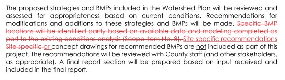
Which explains why the watershed committee was left out of the SMP process and why we got nothing by way of solving the longstanding water quality issues in Murrells Inlet out of the $702k spent for the plan.
You will never find solutions if you fail to implement and you sure won’t find them if you don’t engage with or discuss the solutions with a volunteer committee made up of stakeholders and scientists that has many ideas for solving water quality issues in Murrells Inlet.
Now back to the Land Use Element update!
This is where stormwater plans and land use plans meet in a sense but alignment is a bit off here too. All elements of the CP are connected and should align with other plans too and there are plenty of words about that yet a deeper look shows otherwise.
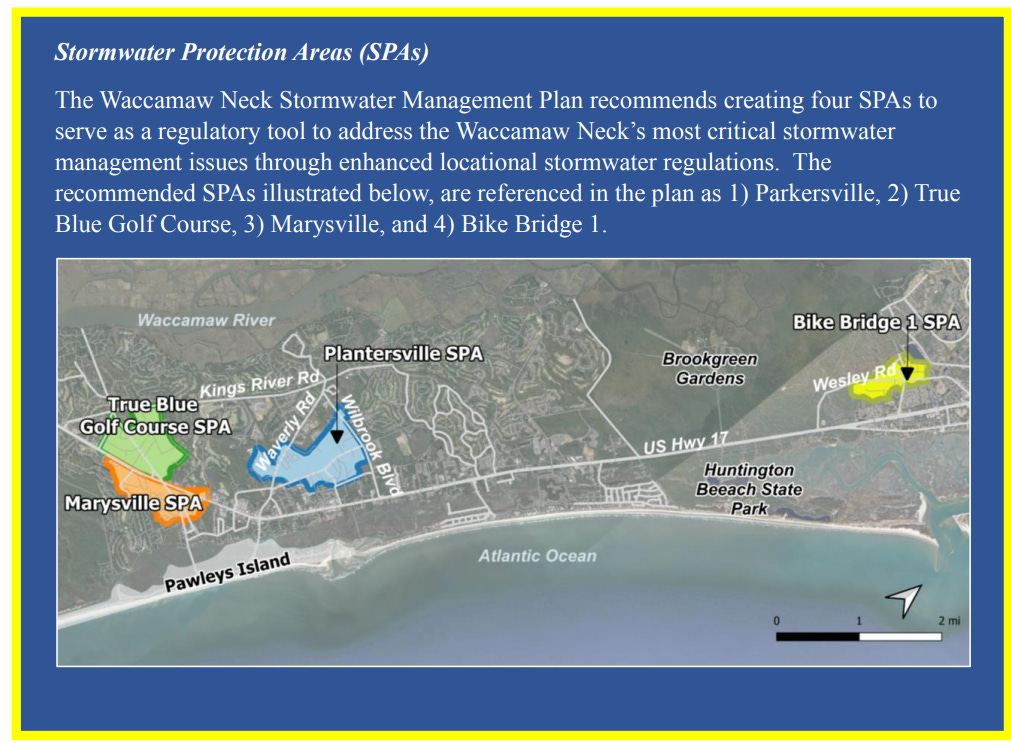
The identified ‘stormwater protection areas’ in the new draft are notable for several reasons. These areas not only lack infrastructure, they have wetlands that are not protected. I’ll leave the story about findings that the area near the Bike Bridge is where the river used to flow to the sea through Murrells Inlet for another day.
While it’s great to see someone notice areas in need of special protection, it remarkably leaves out the fact that there are many areas that lack stormwater infrastructure especially in Murrells Inlet and Pawleys Island where new development has created new flooding problems and the updated LUE calls for higher density. Who doesn’t know by now that increasing development increases impervious surfaces and increases polluted runoff degrades water quality?
The Future Land Use Maps are to be used in decision making. Objective #1 says it all.
Direct commercial, industrial, and residential growth in areas with adequate infrastructure and consistent with the Future Land Use (FLUM) Map.
And now ladies and gentlemen, the future of our land and water and the natural resources we love are about to be demolished and you can thank your county councilor you elected to serve for that.
Thank you for the grim detail and the naked truth. I grieve for the people who grew up at the Inlet, including my late sister-in-law, who saw the live oaks cut down and the homes built closer and closer to the water. Citizens need to use their vote to allow natural resources to survive.
The consulting firm should be ashamed of and sanctioned for their willingness to ignore public outcries in favor of complicity with Georgetown County officials. I've attended every "public input" session held by the consultants, only to be silenced after the first meeting, when it became clear that there were many frustrated and angry residents demanding change. "Input" then was reduced to dots and sticky notes, and emails that were not disclosed to the public. Throwing money at this plan is useless until these county puppets are removed from the equation.